Overview
This plugin automates and simplifies key design workflows, reducing repetitive effort and oversight.
It fetches/geocodes, cleans up layers, and exports palette-safe SVG stacks - cutting time both on data prep and on laser/print layout in apps like LightBurn.
Process Walkthrough
A quick run-through of the ARTographer flow, from location search to export-ready output.
Benefits
- Streamlined workflow
- Faster training
- Consistent results
- Scalable growth
Capabilities
- Inputs: OSM extracts and GeoJSON.
- Outputs: palette-safe SVGs ready for Illustrator/print (laser routing done manually).
- Built-in guardrails: dissolved blocks, tiny-poly cleanup, palette enforcement.
- Runs as the ARTographer plugin with a lightweight server for configs, recipes, and updates.
- Access is invite-only with per-team/user tokens - keeping the tools and recipies internal.
Full feature list
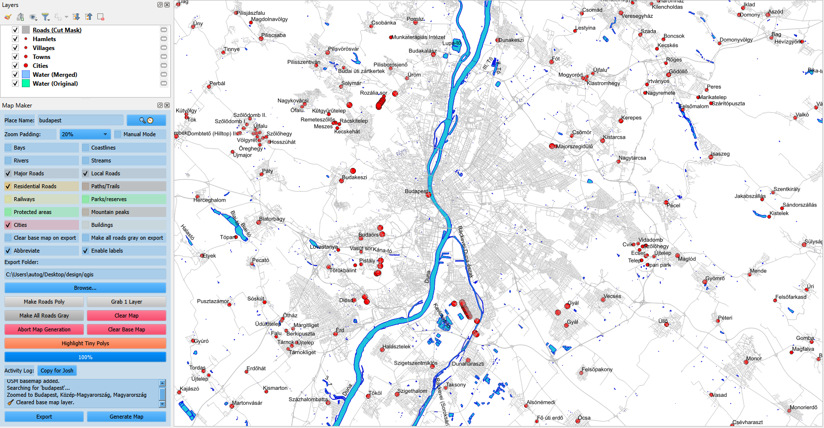
- Place search or manual extent with padding control and DMS coordinates.
- QuickOSM layers with server rotation, retries, and empty-layer cleanup.
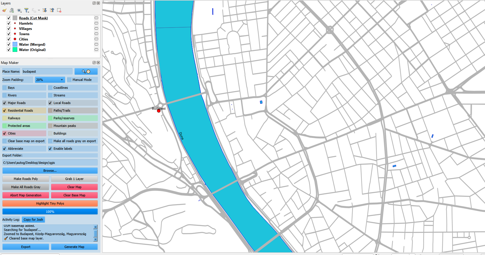
- Water + roads post-processing (dissolve, buffer, clipping, splits).
- One-click helpers: golf stack, tiny polys, custom pins, smooth lake/river, set frame.
- SVG export with optional gray roads and basemap removal.
- Config server for recipes, tooltips, and runtime helpers.
View full feature list
Core workflow
- Nominatim place search with caching and zoom padding.
- Manual mode uses the current map extent.
- Automatic OSM basemap for context.
- Activity log, progress bar, and abort control.
Layer generation
- Water, bays, coastline, rivers, streams.
- Roads split into major/local/residential plus optional paths.
- Railways, parks/reserves, protected areas.
- Mountain peaks, cities, buildings.
- Labeling and name abbreviations.
Single-layer picker
- OSM basemap and water relations by name or ID.
- Lakes, reservoirs (water or landuse), riverbanks.
- Bays, coastline, rivers, streams.
- Major/local/residential roads, paths, railways.
- Nature reserves, parks, protected areas.
- Mountain peaks, cities, towns, villages, hamlets.
- Buildings, airports, lighthouses, slipways, golf courses.
Extra tools
- City Roads polygon mask builder.
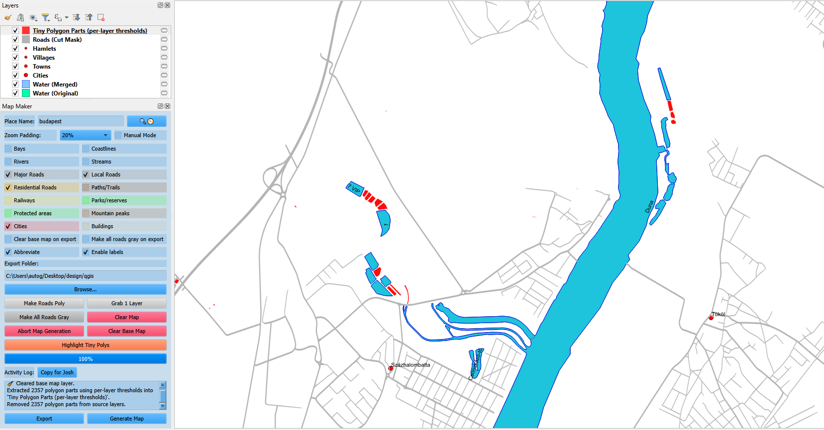
- Tiny polygon cleanup with per-layer thresholds.
- Custom pins from pasted coordinates with SVG markers.
- Lets Golf helper stack with tee-box fallback.
- Smooth lake and smooth river presets.
- Set Frame (W/S/E/N extent) plus clear map and clear basemap.
- Gray Roads toggle and abort current run.
Export and settings
- Export-only mode for the current view.
- Timestamped SVG output to a chosen folder.
- Optional basemap removal and gray-road styling.
- Adjustable river/stream polygon widths.
- Tooltips toggle, defaults reset, and log copy.
Server integration
- Token-protected config server endpoints.
- Remote recipes for layers, golf, and tool settings.
- Runtime helper modules loaded from the server.
Staffing & savings
Adjust the headline assumptions to see how savings shift in real time.
Annual savings: $136,500
Set headcount, pay, hours, and reduction to reflect your team.
Engagement Tiers
Three paths to align commitment level with today's presentation goals - no pricing, just structure.
Tier 1 - Pilot Access
Use the automation system "as-is" for one year with no ownership or sharing rights.
A quick win without long-term obligations.
Tier 2 - Managed Service
Same access plus I handle updates, support, and incremental refinements.
Predictable progress.
Tier 3 - Full Ownership
Transfer the platform, documentation, and IP for complete control going forward.
For those ready to embed automation as a core of their SOPs.
MapFramer: frame-perfect maps
Check this mapping helper out! MapFramer is a separate web app to dial in proportions, orientation, frame size, and map extent in a few clicks - ship the print with confidence.
Open mapframer.space